Oconee Passage

Oconee Passage
Lodging and camping are available at Oconee State Park.
If you are on state park property, camping is only allowed in designated sites. This includes Ross Mtn, Oconee Connector, Eastatoe, Blue Ridge Electric Co-op, and Middle Saluda. If a hiker is on either SCDNR or USFS property, primitive camping is allowed, but the camper is responsible for following the regulations of the managing agency.
One trailhead is located at Oconee State Park where there is an admission fee but the other end of the passage at Oconee Station State Historic Site does not charge a fee.
Only on the USFS section of the Oconee Passage.
Trail Description
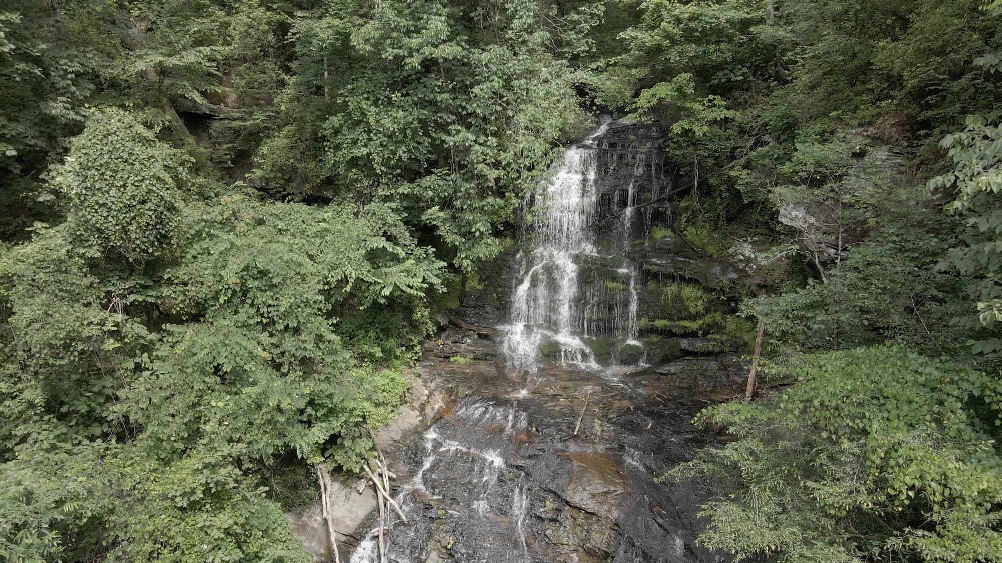
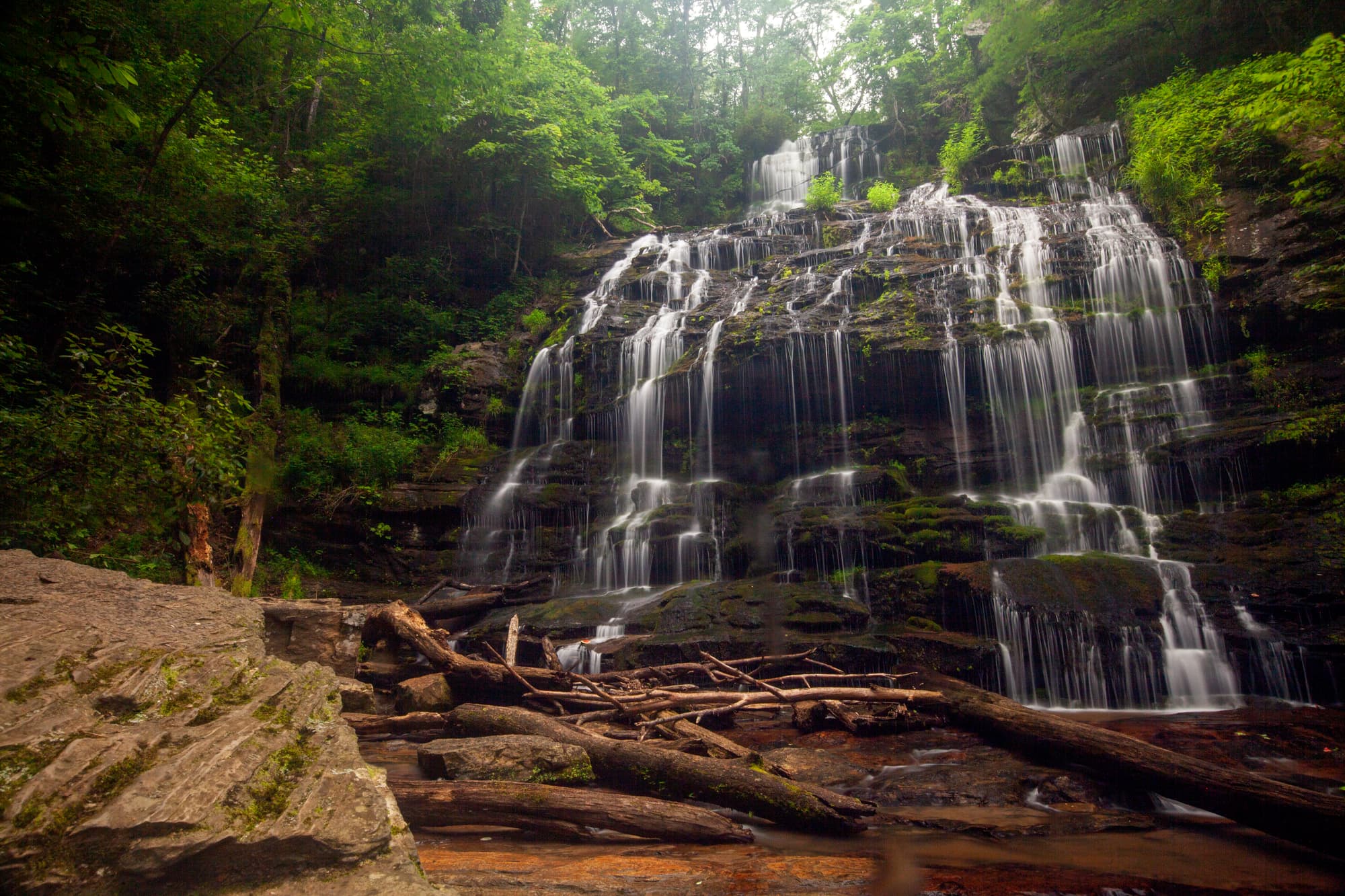
Oconee Passage begins at Oconee Station State Historical Site, a backcountry military garrison and trading post from the 1790s, and ends in Oconee State Park. Less than a mile along the passage, the path rises toward Station Cove Falls Trail where you can choose to walk the quarter-mile spur to the popular Station Cove Falls. One of the prettiest in a county with many waterfalls, this one is a majestic 60-foot, tiered cascade. An amazing array of wildflowers can be found year-round in Station Cove’s botanical area. From here, follow the ridgeline to the northern trailhead. The Foothills Trail crosses Oconee Passage between mile markers 2 and 3. Take the Foothills Trail to trailhead parking, or hike approximately 2 miles in the other direction to Hidden Falls. Camping is available in Oconee State Park. Oconee Station State Historical Site hosts a TRACK Trail nature scavenger hunt for kids.
Directions
Trail Head
Trailheads are located at Oconee State Park and Oconee Station State Historic Site
Trail Head GPS Coordinates
Below are the GPS coordinates for the trail heads. You can also click on the trail head markers in the map below.
Get directions to this trail head
Latitude: 34.86334241792629
Longitude: -83.09806748681598
Get directions to this trail head
Latitude: 34.86405722789854
Longitude: -83.10618845854506
Get directions to this trail head
Latitude: 34.86867072669583
Longitude: -83.10409342703159
Get directions to this trail head
Latitude: 34.86549972645651
Longitude: -83.09469929710659
Get directions to this trail head
Latitude: 34.87184722824117
Longitude: -83.10520236566629
Get directions to this trail head
Latitude: 34.84853380551296
Longitude: -83.07469586061460
Parking GPS Coordinates
Below are the GPS coordinates for the parking locations. You can also click on the parking markers in the map below.
Get directions to this parking location
Latitude: 34.86324727639898
Longitude: -83.09829564338840
Get directions to this parking location
Latitude: 34.86461975454610
Longitude: -83.10677487335106
Get directions to this parking location
Latitude: 34.86593998013904
Longitude: -83.10470947671857
Get directions to this parking location
Latitude: 34.84843857463183
Longitude: -83.07465806402300
Trail Map
Trail Alerts
Dogs must be leashed at all times.
If backpacking, remember to hang food in bear bags.
Remember to bring trash and waste bags to pack out everything that comes in with you, and Leave No Trace.
No metal detectors allowed.