Peak to Prosperity Passage

Peak to Prosperity Passage
Trail Description
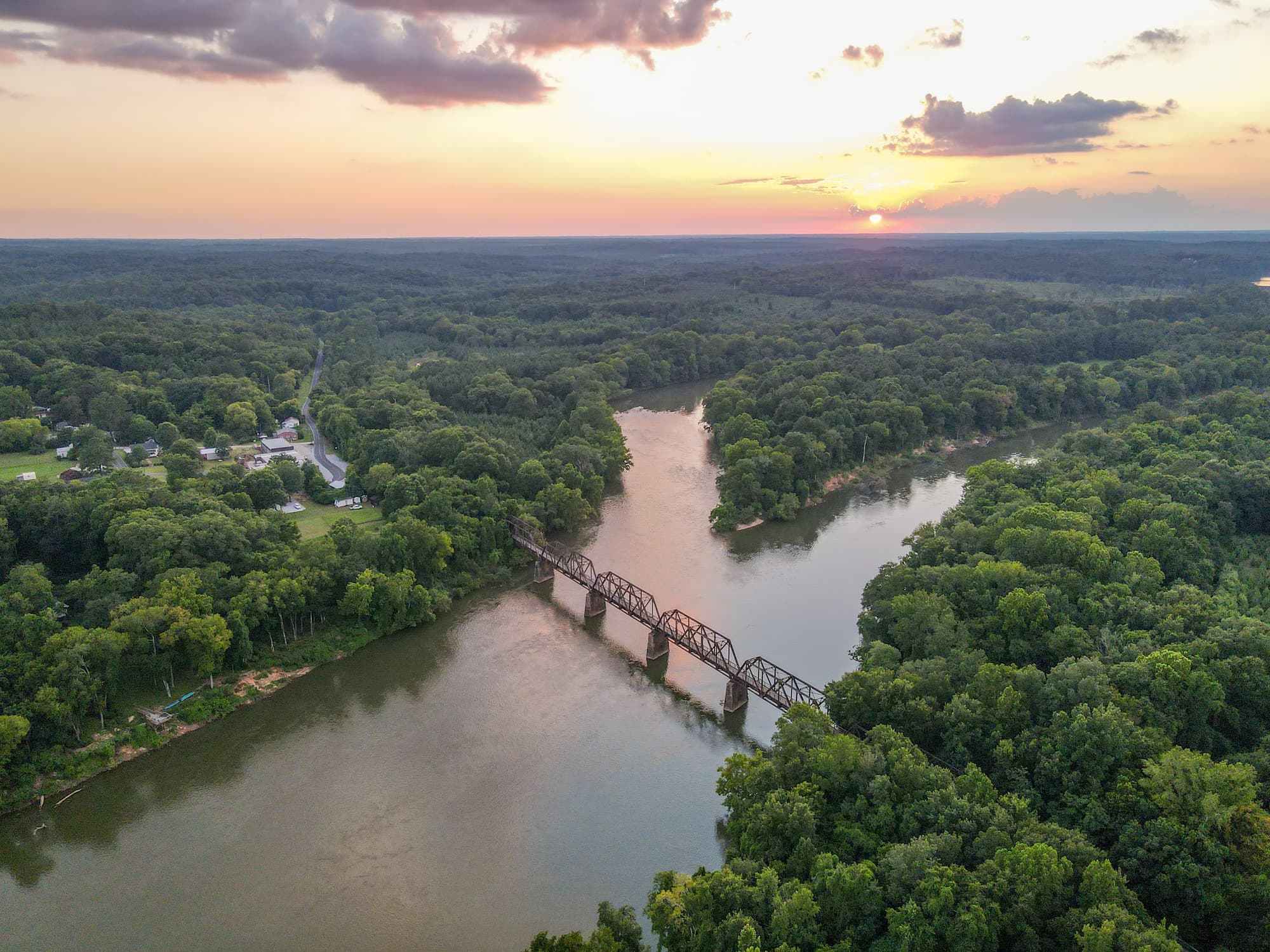
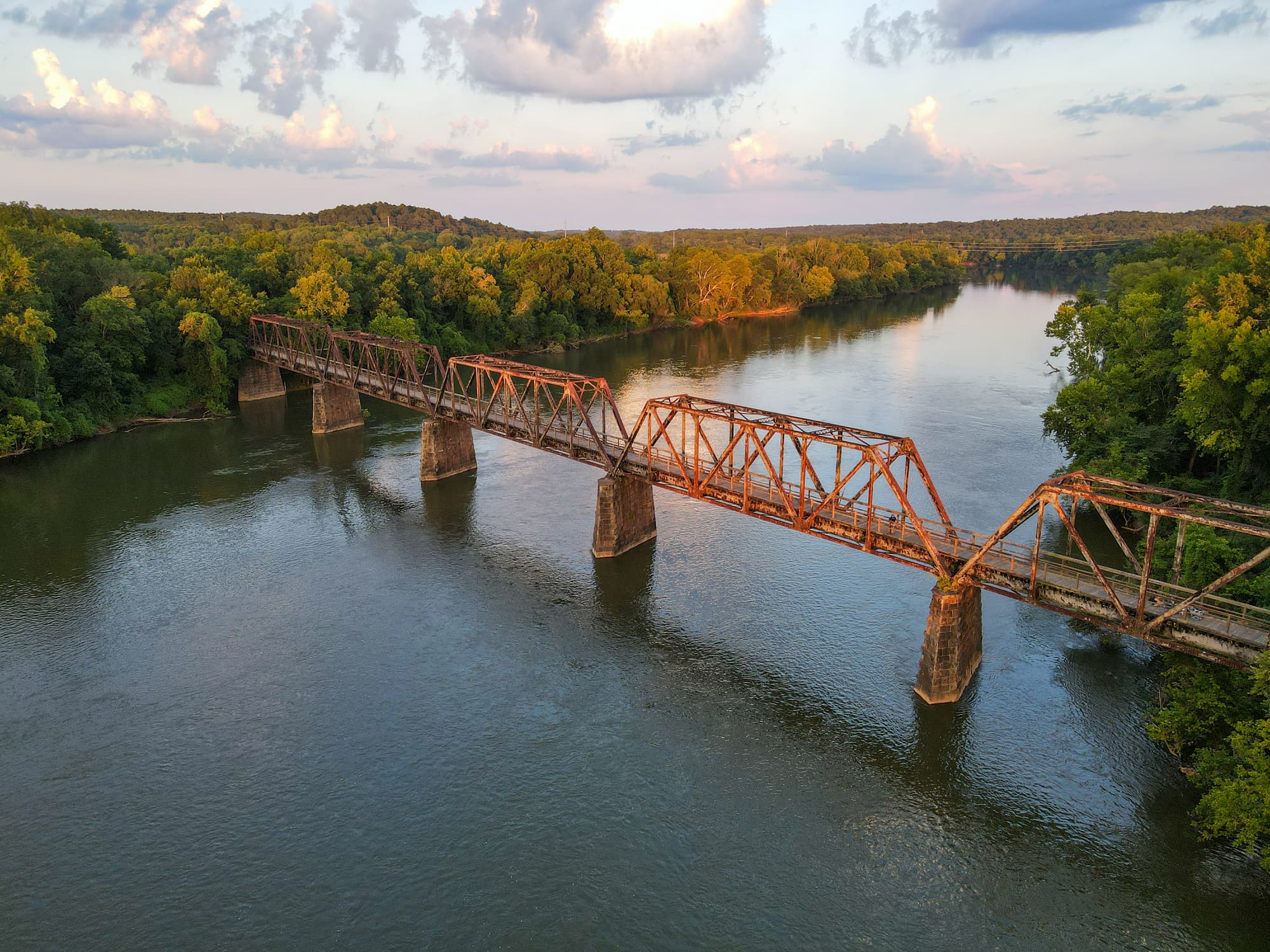
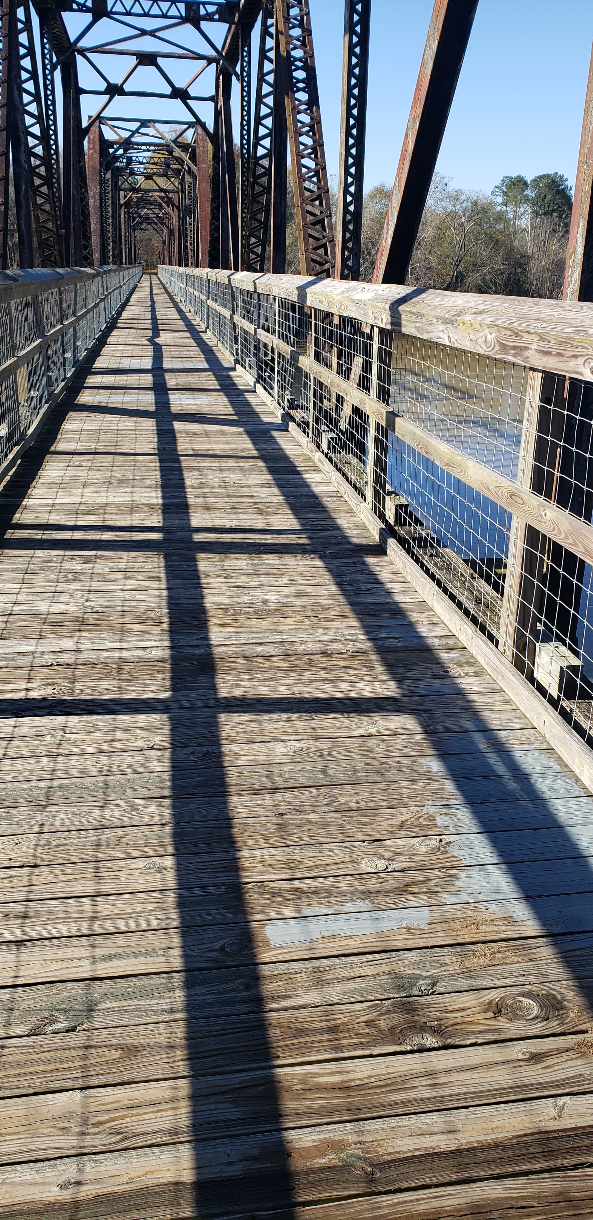
The Peak to Prosperity Passage can be accessed from four spots along its route: Alston, Hope Station, Pomaria and Kibler’s Bridge. The Alston Trailhead is the largest and most spectacular, with immediate access to the impressive Broad River trestle. The view from the 1,100-foot-long bridge is spectacular, especially when bald eagles soar. Across the river in Newberry County, the rail-trail skirts historic Peak and cuts an easy swath through piedmont forest to Pomaria and will eventually connect to Prosperity. Along the passage, 14 wooden trestles span the meandering Crims Creek where German immigrants–Deutsche in their own language– settled in the 1730s. The area is known as the Dutch (Deutsche) Fork.
The Alston Trailhead has become a destination in its own right, with campsites, one of which is accessible, canoe/kayak access, and plenty of spots to picnic or fish. Additional campsites are located between mile markers 5 and 6, near mile marker 7, and on either side of mile marker 8.
In 2020, the Alston Trailhead was the first location on the Palmetto Trail to become part of the Kids in Parks TRACK Trail program. Kids in Parks encourages kids to disconnect from devices and get outside. Each TRACK Trail features self-guided brochures with information about the trail and suggested activities. Adventures can be tracked online.
The 11-mile, 200-foot-wide right-of-way for the Passage was purchased from Norfolk Southern Railroad. Thanks to SC Parks, Recreation & Tourism for funds to convert the river trestle to a Passage treadway, and to Fairfield County for funds to develop the Alston trailhead park.
Additional Information
The Peak to Prosperity Passage became a part of the Kids in Parks TRACK Trail program in 2020. Kids in Parks is an expanding network of family-friendly outdoor adventures called TRACK Trails. Each TRACK Trail features self-guided brochures and signs that turn your visit into a fun and exciting outdoors experience. Best of all, you can earn PRIZES for tracking your adventures!
Directions
Trail Head
Peak/Pomaria/Prosperity
Trail Head GPS Coordinates
Below are the GPS coordinates for the trail heads. You can also click on the trail head markers in the map below.
Get directions to this trail head
Latitude: 34.26289167796354
Longitude: -81.41318730514726
Get directions to this trail head
Latitude: 34.24369682543546
Longitude: -81.31764307041149
Parking GPS Coordinates
Below are the GPS coordinates for the parking locations. You can also click on the parking markers in the map below.
Get directions to this parking location
Latitude: 34.26263072368356
Longitude: -81.41350653894736
Get directions to this parking location
Latitude: 34.26215442144424
Longitude: -81.36830038983423
Get directions to this parking location
Latitude: 34.24353961891777
Longitude: -81.31747884165414
Trail Map
Trail Alerts
This announcement is to notify the surrounding areas of the prescribed burn and be aware of the smoke in the area as a non-emergency.
Dogs must be leashed at all times.
If backpacking, remember to hang food in bear bags.
Remember to bring trash and waste bags to pack out everything that comes in with you, and Leave No Trace.
No metal detectors allowed.
