Blue Ridge Electric Co-op Passage
Blue Ridge Electric Co-op Passage
Fee camping is available at Table Rock State Park.
If you are on state park property, camping is only allowed in designated sites. This includes Ross Mtn, Oconee Connector, Eastatoe, Blue Ridge Electric Co-op and Middle Saluda. If a hiker is on either SCDNR or USFS property, primitive camping is allowed but the camper is responsible for following the regulations of the managing agency.
Blue Ridge Electric Co-Op Passage - One trailhead is located at Table Rock State Park where there is an admission fee but the trailhead on the other end, on Hwy 178, there is no fee to access the trail.
Only on the SCDNR section of the Blue Ridge Electric Co-op Passage.
Trail Description
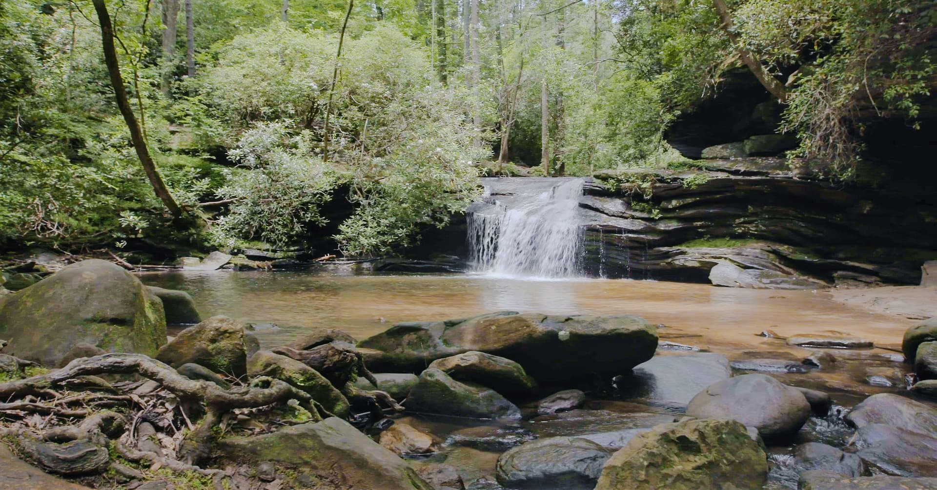
The Jocassee Gorges Wilderness Area has been called a “destination of a lifetime” by National Geographic. The Blue Ridge Electric Co-Op Passage winds through remote and rugged areas, and rewards hikers with an abundance of native flowers and wildlife, mountaintop vistas, waterfalls, and an impressive boulder field. The Passage begins at Pinnacle Pavilion (“The Barn”) in Table Rock State Park and travels through the Wesleyan Camp into the Jocassee Gorges. According to Native American legend, Jocassee means “Place of the Lost One,” a description worth heeding. Take a map! The Jocassee Gorges is owned by the SC Department of Natural Resources. This Passage is hiking only–no motorized vehicles or mountain biking. Parking is available only at Table Rock State Park. Because hunting is allowed in the Jocassee Gorges, check with SC Department of Natural Resources for season dates and plan to wear Blaze Orange in the fall.
Additional Information
Parking is available only at Table Rock State Park.
Trail users should pack adequate food and water.
Hunting occurs in the Jocassee Gorges. Check with SC Department of Natural Resources for season dates.
Directions
Trail Head
Trailheads are located at Table Rock State Park and along SC Hwy 178.
Trail Head GPS Coordinates
Below are the GPS coordinates for the trail heads. You can also click on the trail head markers in the map below.
Get directions to this trail head
Latitude: 35.01334692732755
Longitude: -82.79413976502923
Get directions to this trail head
Latitude: 35.02742061363370
Longitude: -82.70640687537366
Parking GPS Coordinates
Below are the GPS coordinates for the parking locations. You can also click on the parking markers in the map below.
Get directions to this parking location
Latitude: 35.02690506612858
Longitude: -82.70598363657808
Trail Map
Trail Alerts
If backpacking, remember to hang food in bear bags.
Dogs must be leashed at all times.
Remember to bring trash and waste bags to pack out everything that comes in with you, and Leave No Trace.
No metal detectors allowed.